When describing the events of the Battle of Blaauwberg, a major part of the story involves the route of the Highland Brigade following the road that existed in 1806. This main road was an important route from Cape Town, up to the farms in the north that supplied food and wine for the ships and the population. Today the parts that exist are known as the Old Mamre road: in 1806 it would have been called the Groenekloof road.
After attending a virtual talk by Chris Murphy recently on the route of the North Road from Cape Town to Clanwilliam, I was inspired to check out a copy of an old map I have, to see if I could trace the positions of roads through the battlefield. The map I have, was drawn up in 1870, and is known as the Governor’s Map, and shows all the farms that had been demarcated. All existing ox-wagon routes and service tracks are also shown, plus proposed routes for what would now be the N7.
Using a drawing software: I marked up the routes to highlight the road through the battlefield, and it was good to see where the road was located 200+ years ago. What is very evident, is why Baird was so keen to get his troops on the road and why Janssens knew it was important to defend.
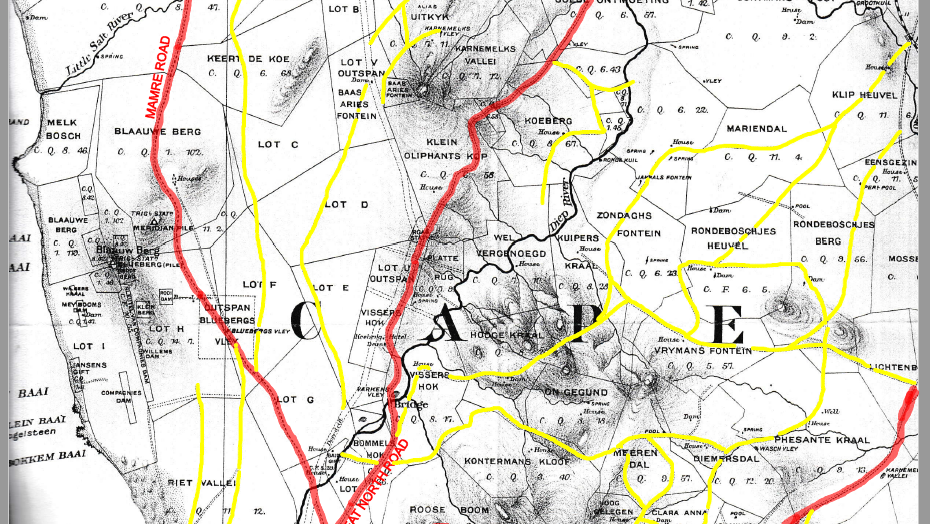
The road that was known as the Groenekloof road started on the outskirts of Cape Town roughly where Maitland interchange now exists. Here the first major obstacle of crossing the Salt River would have been encountered before stopping at the Salt River outspan. With refreshed oxen the route then travelled up past Rietvlei to the next stop at Paalen and Potsdam Outspan. This would have been the road in 1806 that Janssens’ troops would have used to get to their overnight stop on the 7th January 1806 at Blaauwbergsvlei Outspan.
From Blaauwbergsvlei Outspan the route heads north over the battlefield towards the current Blaauwberg Farm, which is now known locally as Joyce’s Dairy. In 1806 this farm was owned by Jan Mostert and was known generally by his name. On the morning of the battle of Blaauwberg, the British left Melkbosch in the early hours and headed towards Mostert’s Farm to get on to the Groenekloof road.
After Mostert’s farm the road carries on inland from Melkbosch and crosses the Little Salt River then heads north picking up a number of watering holes along the way. Eventually the road enters the “slagtersveld” at Mamre, which in 1806 was called Groenekloof. This road would have been the main artery for the Cape to supply fresh meat and produce for the ships restocking on their voyages to and from the East Indies.
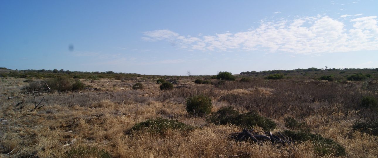
Knowing the history of the road, it is understandable why the invading Britsih army was intent on getting on to it and why the Batavians were desparate in stopping them. Today this main thoroughfare is just an indentation in the ground, but knowing its existance brings to life the events of 8th January 1806. On my battlefield walks I stop and describe the line of the Batavian forces at the precise spot on the road that they defended.
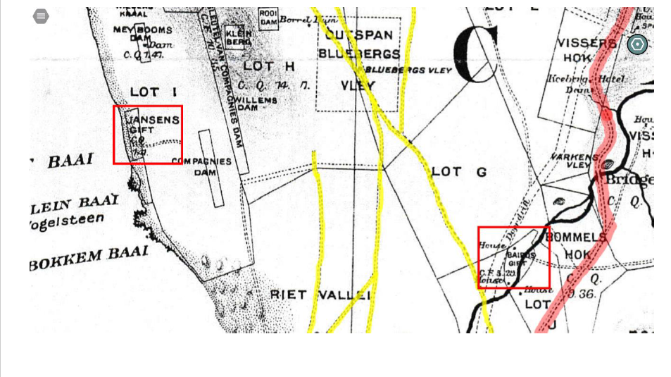
While researching the road I picked up an interesting detail on the map. Two parcels of land were shown as Jansens (sic) Gift and Bairds Gift. From a bit of enquiring I discovered that after the battle people who had helped were awarded with farms and plots of land as a thank you. Knowing who were awarded these plots and what happened to them after, looks to be a good subject for a further post – stay tuned for that one!